Magallanes & El Cano
Infographics for National Geographic
Castellano + abajo
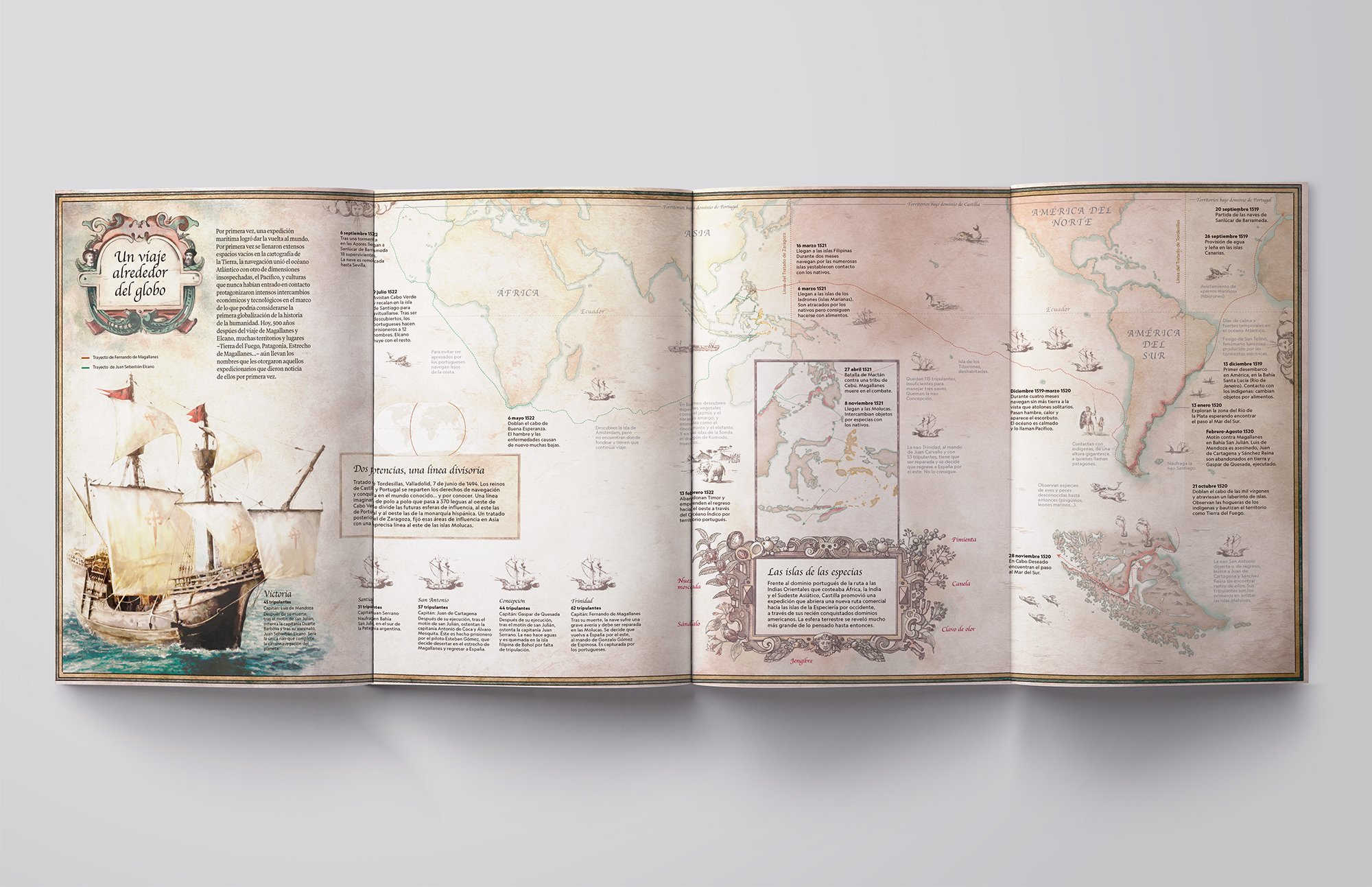
Infographics about the first circumnavigation of the earth carried out by Ferdinand Magellan’s and Sebastián El Cano’s expedition, between 1519 and 1522.
Four-page map where I have summarised the most important milestones of the expedition, explained with illustrations and zooms on the most relevant areas.
—-
Infografía sobre la primera circunnavegación de la tierra realizada por la expedición de Fernando de Magallanes y Sebastián El Cano, entre 1519 y 1522.
Mapa a cuatro páginas donde he resumido los hitos más destacados de la expedición, explicados mediante ilustraciones y zooms sobre las zonas más relevantes.